Moscow

Moscow – tourist information.

  • Teatralnaya Metro Station in Moscow.

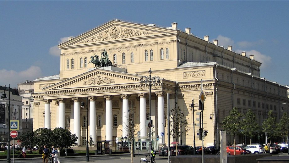
    Teatralnaya metro station in Moscow is located in the city center, beneath Teatralnaya Square. The station is on the Zamoskvoretskaya Line of the Moscow Metro (green line), between Tverskaya and Novokuznetskaya stations. Teatralnaya is connected by passages to Okhotny Ryad and Ploshchad Revolyutsii stations. The Bolshoi and Maly Theaters of Moscow are located near Teatralnaya.

    The station opened on September 11, 1938. It is located at a depth of 35 meters. Structurally, the station consists of three parallel tunnels connected by passages. The cross-section of each tunnel is 9.5 meters. The total platform width is 22.5 meters; the distance between tracks is 25.4 meters. The arch height is 5.3 meters. The total platform length is 155 meters.

    Teatralnaya station is the center of a major transfer hub. From here, you can transfer to Okhotny Ryad station on the Sokolnicheskaya Line and Ploshchad Revolyutsii station on the Arbatsko-Pokrovskaya Line. There are two ways to get to each of these stations: via underground passages and through shared above-ground vestibules.
    The passages are located in the center of Teatralnaya Station, accessible via stairs above the tracks.

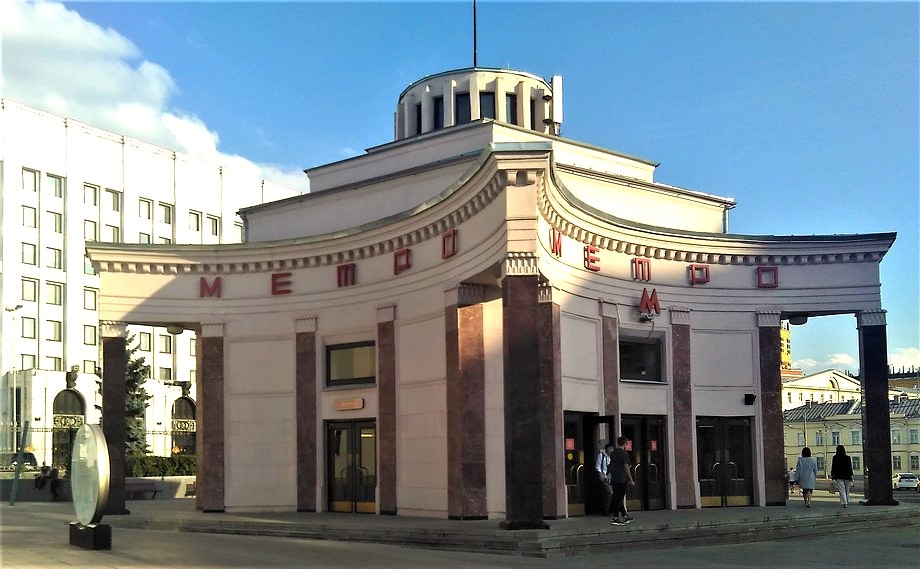
    Teatralnaya metro station has two above-ground vestibules.
    Teatralnaya’s southern vestibule is shared with Ploshchad Revolyutsii station and is located on Revolyutsii Square.
    Teatralnaya’s northern vestibule is shared with Okhotny Ryad station and is the closest exit to the theater. This vestibule is built into a building at the intersection of Bolshaya Dmitrovka Street and Teatralny Proyezd Street, on the edge of Teatralnaya Square. A passage leads from this vestibule to the Teatralnaya escalator.

    Near the Teatralnaya metro station in Moscow are the following:

    The Bolshoi Theater. Address: Teatralnaya Square, 1.
    The State Academic Maly Theater of Russia. Address: Teatralny Proyezd, 1.
    The Russian Academic Youth Theater. Address: Teatralnaya Square, 2.
    The Moscow Operetta. Bolshaya Dmitrovka Street, 6.
    The Chekhov Moscow Art Theater. Kamergersky Lane, 3.
    The Moscow State Exhibition Hall. Georgievsky Lane, 3.
    Red Square.
    The Moscow Kremlin.
    The State Historical Museum.
    The Moskva Hotel. Okhotny Ryad Street, 2.
    The Metropol Hotel. Teatralny Proyezd, 2.
    The Central Department Store. Petrovka Street, 2.

  • Kurskaya and Chkalovskaya Metro Stations in Moscow

    The Kurskaya and Chkalovskaya metro stations in Moscow are located approximately 2.5 kilometers east of the city center (the Kremlin and Red Square), next to Kursky Railway Station. Kurskaya metro stations are located on two Moscow Metro lines: the Arbatsko-Pokrovskaya Line (Line 3, blue line) and the Circle Line (Line 5, brown line). Chkalovskaya metro station is located on the Lyublinsko-Dmitrovskaya Line (Line 10, light green line) of the Moscow Metro. The stations are connected by passages, allowing transfers between the three metro lines.

    Kurskaya Metro Station (Arbatsko-Pokrovskaya Line)

    Kurskaya metro station on the Arbatsko-Pokrovskaya Line of the Moscow Metro is located between Baumanskaya and Ploshchad Revolyutsii stations. The station opened on March 13, 1938. The station’s boarding hall is located under Zemlyanoy Val Street. The station exit (escalators) is located at the eastern end of the hall.

    The station has transfers to the station of the same name on the Circle Line and to the Chkalovskaya station on the Lyublinsko-Dmitrovskaya Line. The transfer to the Circle Line is in the center of the hall. The transfer to the Lyublinskaya Line is at the western end of the hall.

    The station exits through a round underground hall, next to which are the ticket counters. This same hall also provides access to the Circle Line station. From the station, you can exit into the Kursky Station waiting room, the above-ground concourse (located on the first floor of a residential building on Kursky Station Square), and through a pedestrian crossing under the railway tracks to Nizhny Susalny Lane.

    Kurskaya Metro Station (Circle Line)

    Kurskaya Station on the Moscow Metro’s Circle Line is located beneath Kursky Station Square between Komsomolskaya and Taganskaya stations.
    The station opened on January 1, 1950.

    The station has two vestibules. The northern vestibule is shared with the Arbatsko-Pokrovskaya Line station. It is located in the northern part of Kursky Station Square and has exits into the station building and onto the square. The southern vestibule is located in the southern part of Kursky Station Square and is shared with Chkalovskaya Station.

    The transfer to Kurskaya Station on the Arbatsko-Pokrovskaya Line is located in the center of the station’s boarding hall (stairs above the platform, then along a corridor). Transfer to Chkalovskaya Station is through a vestibule shared by both stations.

    Chkalovskaya Metro Station

    Chkalovskaya Metro Station is located on the Lyublinsko-Dmitrovskaya Line of the Moscow Metro, between Sretensky Bulvar and Rimskaya stations. The station opened on December 28, 1995. From the station, you can transfer to Kurskaya Station on the Arbatsko-Pokrovskaya and Koltsevaya Lines.

    The transfer to Kurskaya Station on the Arbatsko-Pokrovskaya Line is located at the northern end of the central hall. The transfer to Kurskaya Station on the Koltsevaya Line is at the southern end of the hall. Exit to the city and transfer to the Koltsevaya Line are via the above-ground vestibule. The vestibule is shared by both stations and is located in the southern part of Kursky Station Square.

    The station’s design is dedicated to the famous pilot Valery Chkalov (1904-1938). When the station was designed, Zemlyanoy Val Street was named Chkalov Street. This explains the choice of the station’s name. In 1992, the street was reverted to its historical name.

    Near the Kurskaya metro station and Kursky Railway Station in Moscow are:

    Kursky Railway Station.
    Atrium Shopping Center.

  • Arbatskaya Metro Stations in Moscow

    Arbatskaya metro stations are located on two lines of the Moscow Metro: the Arbatsko-Pokrovskaya Line and the Filevskaya Line. The stations are located in the center of Moscow, approximately 1 kilometer from Red Square and the Moscow Kremlin. The station ground-level concourses are located near Arbatskaya Square and famous Moscow streets: Arbat, Novy Arbat, and Vozdvizhenka.

    Arbatskaya Metro Station (Arbatsko-Pokrovskaya Line)

    Arbatskaya metro station on the Arbatsko-Pokrovskaya Line of the Moscow Metro is located between Ploshchad Revolyutsii and Smolenskaya stations. The station opened on April 5, 1953. The station’s underground hall is 220 meters long (one of the longest halls in the Moscow Metro). The station’s depth is 41 meters.

    Arbatskaya metro station on the Arbatsko-Pokrovskaya Line of the Moscow Metro is part of Moscow’s largest transfer hub (connecting four stations on four metro lines). From this station, you can transfer to Biblioteka Imeni Lenina on the Sokolnicheskaya Line, Aleksandrovsky Sad on the Filevskaya Line, and Borovitskaya on the Serpukhovsko-Timiryazevskaya Line.

    The station’s ground-level vestibule is located near the intersection of Vozdvizhenka Street and Krestovozdvizhensky Lane. The vestibule is integrated into the building of the Russian Ministry of Defense.
    Transfers to the Sokolnicheskaya (Biblioteka imeni Lenina station) and Filevskaya (Aleksandrovsky Sad station) lines are via an escalator located at the eastern end of the vestibule (from there, you can also exit to the city at Aleksandrovsky Sad and Mokhovaya Street). A staircase located in the center of the vestibule leads to Borovitskaya station (Serpukhovsko-Timiryazevskaya line). There is no transfer to Arbatskaya station on the Filevskaya line (2014).

    Arbatskaya Metro Station (Filyovskaya Line)

    Arbatskaya station on the Moscow Metro’s Filevskaya line is located between Aleksandrovsky Sad and Smolenskaya stations. Built on the site of a 17th-century church, the station opened on May 15, 1935. The station is 8 meters deep. The station’s ground-level vestibule is located on Arbatskaya Square, near Znamenka, Gogolevsky Boulevard, Arbat, and Novy Arbat streets. The ground-level vestibule is a separate building shaped like a five-pointed star. The station’s vestibule became one of the first symbols of the Moscow Metro.

    Near the Arbatskaya metro station in Moscow are:
    Pedestrian Arbat Street (one of Moscow’s landmarks).
    The Vakhtangov Theater.
    The distance to the Kremlin is approximately 750 meters.

  • Ploshchad Revolyutsii Metro Station in Moscow

    Ploshchad Revolyutsii Metro Station is located in the very center of Moscow, close to many famous landmarks and popular tourist spots. The station is also known for the sculptures located in its underground concourse.

    Ploshchad Revolyutsii Metro Station is a station on the Arbatsko-Pokrovskaya Line of the Moscow Metro. It is located between Kurskaya and Arbatskaya stations. The station has a connecting connection to Teatralnaya Station on the Zamoskvoretskaya Line, from where you can transfer to Okhotny Ryad Station on the Sokolnicheskaya Line of the Moscow Metro.

    The station opened on March 13, 1938. The entrances from this station are located next to Ploshchad Revolyutsii (hence the name). The station was designed by architect A.N. Dushkin.

    Sculpture at the Ploshchad Revolyutsii metro station in Moscow

    A few figures: depth – 34 meters; The overall platform width is 22.5 meters; the distance between tracks is 25.4 meters; the height of the boarding hall vault is 5.3 meters; and the platform length is 155 meters.

    The station has two above-ground vestibules. The western vestibule is located on Revolution Square and is shared with Teatralnaya Station (from here, you can go to both Revolution Square and Teatralnaya Stations). The station’s eastern vestibule is built into a building located on the corner of Bogoyavlensky Lane and Nikolskaya Street.

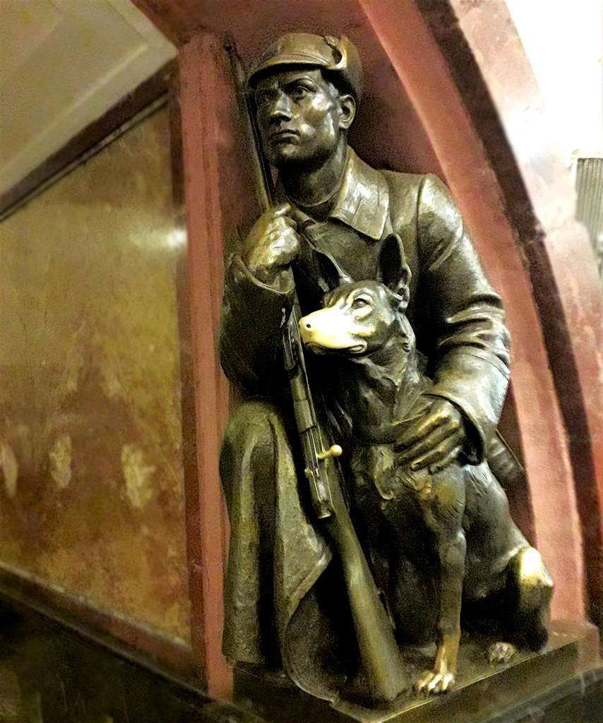
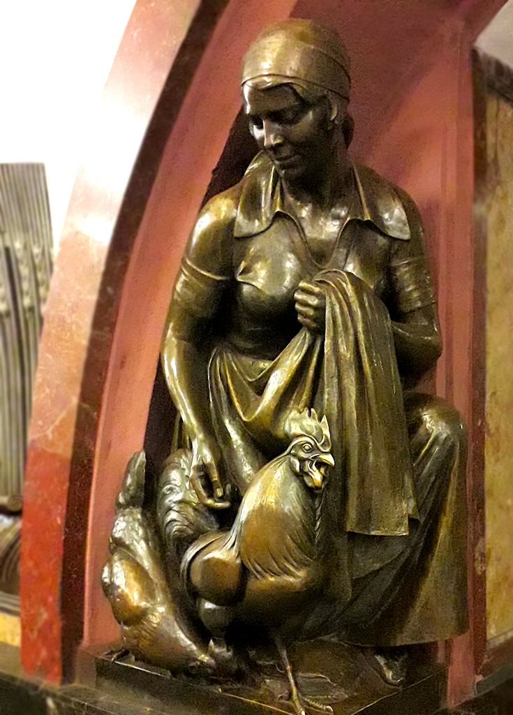
    A distinctive feature of Revolution Square metro station are the bronze sculptures located in its underground vestibule. There are 76 sculptures in total, 18 of which are repeated four times, and two of which are repeated twice. The sculptures depict a total of 20 images. The sculptures were created at the Leningrad Art Casting Workshop under the direction of sculptor M. G. Manizer. The sculptures installed at the station depict Soviet people, as was common practice in the USSR during the station’s construction. They depict workers, peasants, soldiers, sailors, students, etc. The sculptures were intended to serve as a kind of propaganda tool. Today, they can be considered a cultural monument of the USSR of the mid-20th century.

    Sculpture at the Ploshchad Revolyutsii metro station in Moscow

    Some of the sculptures are associated with certain superstitions. For example, to ensure you pass an exam, you should rub the nose of the dog near the “Border Guard with a Dog” sculpture; touching the revolver near the revolutionary sailor sculpture will ensure a successful day.

    Sculpture with a dog at the Ploshchad Revolyutsii metro station

    Some of the landmarks located near the Ploshchad Revolyutsii metro station:

    Moscow Kremlin. The Moscow Kremlin is the main landmark of the Russian capital and a symbol of Russia. The Kremlin grounds are the historical center of the city. The Moscow Kremlin Museum manages the Kremlin’s tourist attractions.
    Red Square. Red Square is the main square of Russia. All tourists visiting the Russian capital stop by this place. The square is home to the Kremlin’s most famous tower, the Spasskaya Tower. (Distance from the metro station is approximately 240 meters.)
    St. Basil’s Cathedral. The most famous cathedral in Moscow and Russia (Pokrovsky Cathedral). One of Moscow’s most beautiful churches. (Distance approximately 500 meters.)
    Kazan Cathedral. (Cathedral of Our Lady of Kazan.)
    Bolshoi Theater. Russia’s most famous theater. The theater is known throughout the world. (Distance approximately 370 meters.)
    Historical Museum. Russia’s largest historical museum is located on Red Square. (Distance approximately 250 meters.)
    Polytechnic Museum (Distance approximately 650 meters.)

  • Kolomenskoye park

    Kolomenskoye is a popular place to spend free time among Moscow residents and one of the city’s landmarks. Kolomenskoye is a large park on the banks of the Moskva River. The park boasts many interesting architectural landmarks.

    Kolomenskoye Park and Museum is located approximately 10 kilometers south of the city center (the Kremlin and Red Square). The park covers approximately 390 hectares and stretches approximately 2.7 kilometers from north to south.

    The village of Kolomenskoye was located on the road from Moscow to Kolomna. The first written mention of the village of Kolomenskoye dates back to 1336. For many years, Kolomenskoye was the patrimony of the Moscow grand princes, and one of the residences of the Russian tsars was located here. After the Russian capital was moved to St. Petersburg, Kolomenskoye became less visited by members of the royal family. The Kolomenskoye Museum was founded in 1923. Kolomenskoye is now part of the city of Moscow. The Kolomenskoye Park and Museum is part of the Moscow State United Artistic, Historical, Architectural, and Natural Landscape Museum-Reserve.

    The Kolomenskoye Museum grounds contain monuments of Russian architecture from the 16th to 18th centuries. The most famous is the Church of the Ascension in Kolomenskoye, built in 1532. Interesting events are often held in the park.

    Address: Moscow, Andropov Avenue, 39.
    Entrances to the park are located near the Kolomenskaya and Kashirskaya metro stations.
    You can find the park’s location on a map of Moscow.
    Отправить отзыв

  • Izmailovo park and museum in Moscow

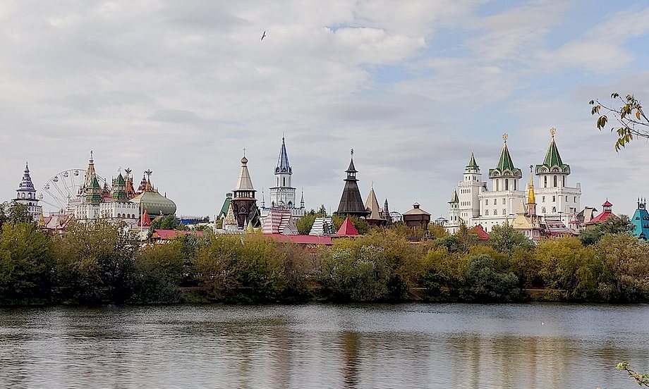
    Izmailovo is a former royal estate built in the second half of the 17th century east of Moscow on the Serebryanka River. Izmailovo is currently part of the Moscow State United Artistic, Historical, Architectural, and Natural Landscape Museum-Reserve. It is a park located on a small artificial island. The island contains several interesting historical architectural landmarks.

    Moscow. Izmailovo.

    Izmailovo Park and Museum is located approximately 10 kilometers northeast of the city center (the Kremlin and Red Square). The distance to the Moscow Ring Road (MKAD) is approximately 5 kilometers. The island stretches approximately 800 meters from east to west and approximately 400 meters from north to south.

    Izmailovo was the ancestral estate of the Romanov boyars. The estate was granted to a member of this dynasty by Tsar Ivan the Terrible. In 1654, the village passed into state ownership, becoming the royal family’s country estate. Between 1664 and 1691, the estate was rebuilt. A pond was created around the estate. The estate was located on an artificial island. It was on this pond that the future Tsar Peter the Great learned the basics of naval navigation.

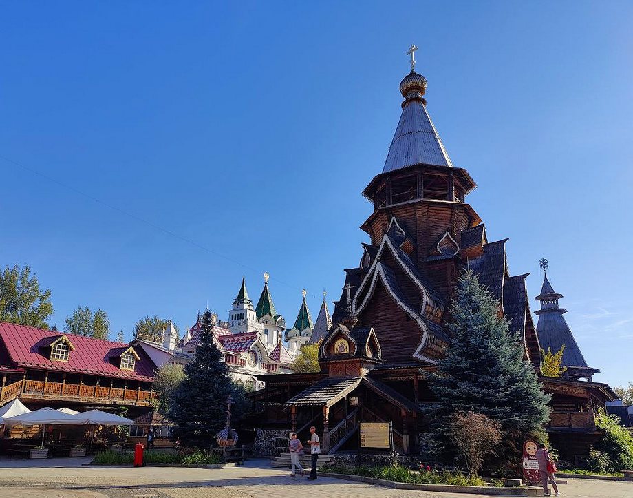
    Moscow. Izmailovo.

    Several ancient buildings remain on Izmailovsky Island: the Bridge Tower (1671–1679), the Cathedral of the Intercession (1671–1679), and the Front and Rear Entrance Gates (1679–1682).

    Address: Moscow, Bauman Town, Building 2, Bldg. 14.
    Nearest metro station: Partizanskaya.

    The Kremlin in Izmailovo
    The Kremlin in Izmailovo is a cultural and entertainment complex located on the western shore of the Serebryano-Vinogradny Pond, next to the Izmailovo estate. The Kremlin buildings are modern, constructed in a style characteristic of old Russian architecture. The Kremlin grounds house several museums (the Bread Museum, the Chocolate Museum, the Russian Toy Museum, the Vodka History Museum, and the Russian Navy History Museum), art workshops (the “Russian Compound” crafts center), a wedding palace, and a business center. Various entertainment events for the public are organized within the “Izmailovo Kremlin.”

    Partizanskaya is the nearest metro station.
    Address: Izmailovskoye Shosse, 73Zh, Moscow.
    Find the location on a Moscow map.

  • Tsaritsyno park

    Tsaritsyno is a large park containing architectural landmarks and museums. The park includes a palace complex, greenhouses, ponds, a musical fountain, and other features. The museum-reserve covers approximately 400 hectares.

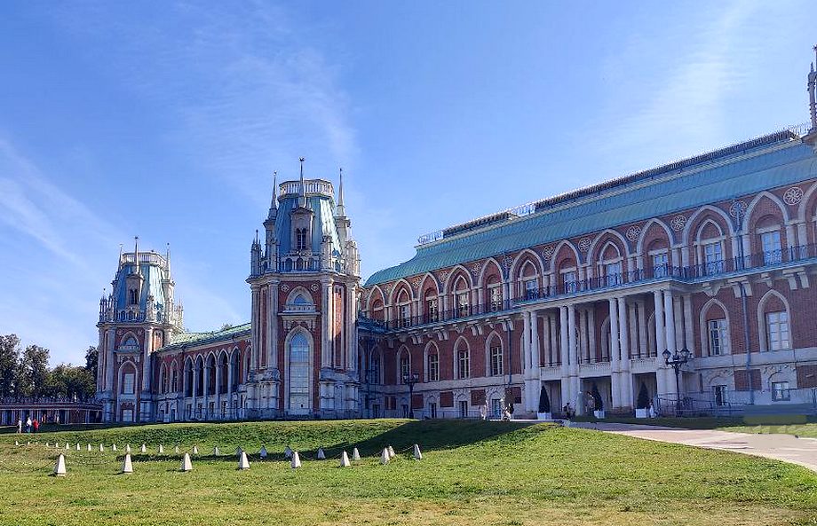
    The Tsar’s residence, Tsaritsyno, was founded by order of Empress Catherine II in 1776. The palace was built in the so-called “Russian Gothic” (pseudo-Gothic) style. The palace and other buildings remained unused for many years. Currently, it hosts exhibitions and other events. The park is a popular place for strolls in fine weather. Classical and contemporary music concerts are held in the halls of the Grand Palace and the park grounds (in summer). Tsaritsyno is also the site of music festivals.

    Tsaritsyno, Moscow.

    Museum address: 115569, Moscow, Dolskaya Street, Bldg. 1
    Nearest metro station: Tsaritsyno.
    Find the park’s location on a map of Moscow.

  • Zaryadye Park in Moscow

    Zaryadye Park is one of the most visited place in Moscow. Most tourists visiting Moscow include a visit to the park in their itinerary. The park is located in the very center of the city and is easily accessible by foot from the Kremlin and Red Square.

    The park opened on September 9, 2017. The Rossiya Hotel previously stood on the site of the park. Why is the park called Zaryadye? Zaryadye is a historical district of Moscow. The first mention of Zaryadye dates back to 1365. The area was located “behind the rows” of shops, hence the name “Zaryadye.”

    The park is located in the city center, between Red Square and the Moskva River. More precisely, it lies between Kitaygorodsky Proyezd, Varvarka Street, and Moskvoretskaya Embankment. The park covers an area of ​​13 hectares. It stretches approximately 450 meters from west to east (along the Moskva River) and approximately 300 meters from north to south (between the Moskva River and Varvarka Street).

    Getting to Zaryadye Park is very easy. From Red Square, go behind St. Basil’s Cathedral and you’ll reach the park. The nearest metro station to Kitay-Gorod Park (south exit) is approximately 150 meters away. Lubyanka, Okhotny Ryad, Teatralnaya, and Ploshchad Revolyutsii stations are also within walking distance.

    The park represents four Russian landscape zones: tundra, steppe, forest, and swamp. Over 700 trees and 7,000 shrubs have been planted within the park.

    The park also includes:

    The Floating Bridge observation deck, which offers views of the river and Stalin’s skyscraper. (This is the most visited place in the park.)
    Zaryadye Concert Hall.
    Gastronomic center (food court).
    Exhibition hall.
    Florarium greenhouse.

    I’m not really a big fan of Zaryadye Park. I prefer more natural parks, and Zaryadye is too urban. But it’s easy to get to while walking around the city center. And it offers truly beautiful views of Moscow. That’s why I come here every time I’m in Moscow.

    Near the park, there’s also a pier from which you can take a river cruise along the Moskva River.
    We recommend visiting this place if you’re planning a visit to Moscow.

  • Sparrow Hills – Vorobyovy Gory in Moscow

    Sparrow Hills in Moscow is one of the most popular places among city residents. It is also a frequent destination for tourists visiting Moscow. Sparrow Hills is famous for its beautiful views of Moscow and is also a great place for strolls.

    Sparrow Hills (Воробьёвы горы, Vorobyovy Gory) is a section of the high bank of the Moskva River. The hilly, forested terrain rises up to 80 meters above the river. It stretches along the Moskva River for approximately 3.7 kilometers.

    Vorobyovy Gory is located approximately 6.5 kilometers southwest of the Kremlin and Red Square. Luzhniki Stadium is located on the opposite bank of the river.

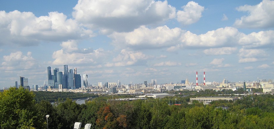
    Sparrow Hills in Moscow

    In the photo: View of Moscow from Sparrow Hills.

    Are Sparrow Hills truly such an interesting place and worth your attention (visit)? What do tourists think?
    It depends on your tastes and preferences.
    A romantic and travel enthusiast will say: What a breathtaking and inspiring view of Moscow! Moscow! I’m ready to conquer you!
    A pragmatist will counter: just a high bank, some buildings in the distance, and a small river below.
    And some will simply enjoy a stroll in their free time, either along the embankment by the river or on its (the river’s) high bank.
    You have to be there, at least to take a selfie.

    About the name: Sparrow Hills has nothing to do with sparrows. From the early 14th century, a village stood in this area, originally belonging to the Vorobyov boyars. “Vorobey” means “sparrow” in Russian. The village was named after them—Vorobyevo. This explains the area’s name.

    For centuries, Vorobyovy Gory was the first viewpoint of Moscow for travelers and conquerors coming to Rus’. Today, the Vorobyovy Gory is the destination for most tourists visiting Moscow. (From 1935 to 1999, the area was known as “Lenin Hills.”)

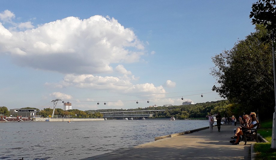
    Embankment of the Moscow River.

    Pictured: The Moskva River embankment near Vorobyovy Gory.

    The most famous building on Vorobyovy Gory is the main building of Moscow University. It also features a ski jump and a floodlit ski slope.

    The Vorobyovy Gory area includes the Vorobyovskaya and Andreyevskaya embankments of the Moskva River. Here you can cycle, roller skate, jog, or simply stroll. There’s a pier on the embankment where pleasure boats dock.

    The observation deck offers a beautiful view of the city, including the high-rise buildings of Moscow City and Luzhniki Stadium. The observation deck is located directly across from the university building. A pedestrian path leads from the observation deck to the embankment. A tourist bus stop is located near the observation deck.

    The two banks of the river are connected by a cable car. (Cable car rides are very popular with tourists.)

    Nearest metro station: Vorobyovy Gory.

    You can check the location of this landmark on the Moscow map.

    You can choose different routes to get to Vorobyovy Gory.

    One option is to take the metro to Universitet station and walk past the main university building to the observation deck. Then you can walk down to the embankment. At the pier, you can buy a boat ticket and take a tour of the Moskva River.
    You can also take the metro to Vorobyovy Gory station and walk up to the observation deck. (The metro station is located on the bridge over the Moskva River.)
    You can also buy a ticket for a tourist bus and travel to Vorobyovy Gory by bus.
    Vorobyovy Gory on the Moscow map.

  • Ostankino TV Tower

    The Ostankino TV Tower is one of the tallest structures in the world and it is one of Moscow’s landmarks.. Standing 540.1 meters tall, it houses television and radio broadcasting antennas, as well as other equipment.

    The Ostankino TV Tower is located in Moscow’s Ostankino district, approximately 7.3 kilometers north of the Kremlin and Red Square. The tower is near Ostankino Park and the All-Russia Exhibition Center (VDNKh). (The distance from VDNKh is approximately 2.5 kilometers, if you walk.)

    The tower was built between 1960 and 1967. The TV Tower is a member of the World Federation of Great Towers. Its glass observation deck is located at an altitude of 337 meters. An open-air observation deck is located at an altitude of 340 meters.

    The Ostankino TV Tower is also known for its restaurant, “Seventh Heaven.” The restaurant occupies three floors at an altitude of 328-334 meters. In addition to food and drinks, the restaurant offers its customers excellent views of the city. The restaurant’s dining rooms rotate.

    Please note! If the weather is foggy or low cloud cover is present, you will likely not be able to see anything from the tower’s observation decks. You will be warned about this before visiting.

    Ostankino TV tower on a cloudy day.

    In the photo: Ostankino TV tower on a cloudy day.

    The TV Tower’s official website is www.tvtower.ru.

    Ticket prices (adult) for June 2026:

    • Route #1 “Moscow Panorama 360°” — 1900/2300 rubles (weekdays/weekends and holidays).
    • Route #2 “Tower Inside” — 2600/2900 rubles (weekdays/weekends and holidays).

    Check all ticket options on the Tower’s website.
    Important! To visit, you must have an identity document with you.

    Guests can access an observation deck at a height of 337 meters (with sections of transparent floor), open balconies at heights of 85 meters and 340 meters, and a souvenir shop.

    Address: Moscow, Akademika Koroleva Street, 15, Building 2.
    The nearest metro station, VDNKh, is approximately 1.6 kilometers away.
    The location of the Ostankino Television Tower can be found on a map of Moscow.

Яндекс.Метрика
Мы не регистрируем новых пользователей, не собираем персональные данные. Наш сайт и партнёры, такие как яндекс-метрика, рекламная сеть Яндекса и другие могут использовать cookie-файлы для наилучшего представления вам информации. Продолжая использовать этот сайт, вы соглашаетесь с использованием cookie-файлов.
Принять